
Please be advised the conservation advice package for The Canyons MCZ was published on 29 May 2026. This is JNCC’s formal conservation advice for the site and can be accessed via the conservation advice section of this Site Information Centre.
Please note that the structure of this conservation advice package has been revised to support ease of access and understanding for users. More detail is provided in the conservation advice section below.
Please note, as of 13 June 2022, new fisheries management measures are in force for The Canyons Marine Conservation Zone. For more information about these fisheries measures, please visit the gov.uk website.
Status: Marine Conservation Zone (MCZ)
The Canyons MCZ is located in the far south-west corner of the UK continental shelf and is unique within the context of England’s largely shallow seas due to its depth, sea-bed topography and the coral features it contains.
Video
Site
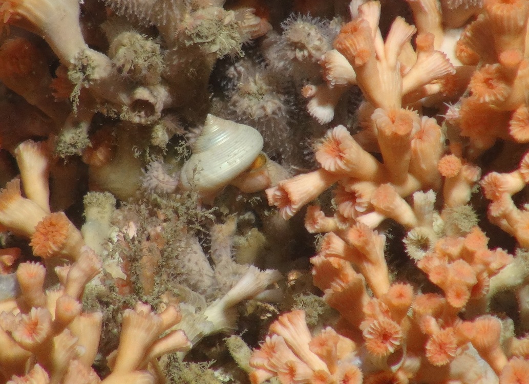
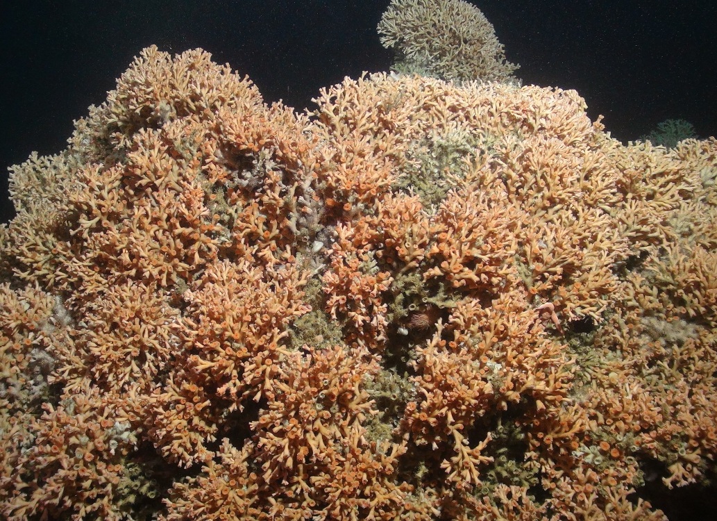
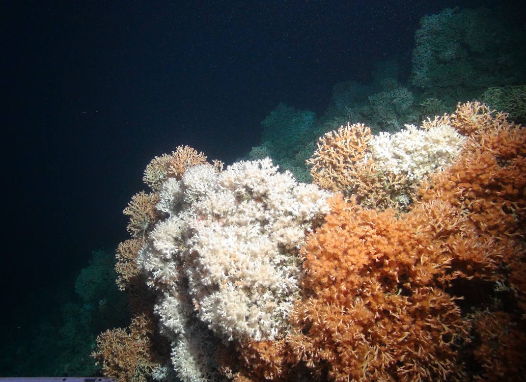
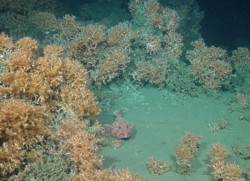
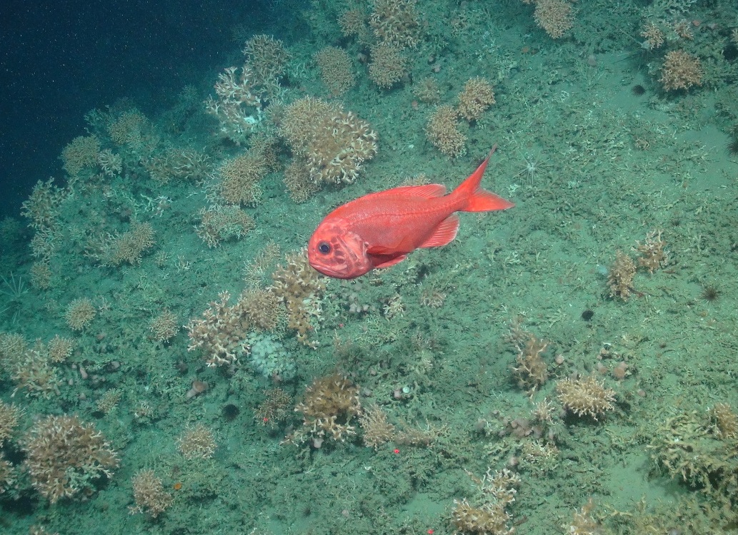
The Canyons MCZ is located in the far south-west corner of the UK continental shelf. The site lies at the edge of the shelf, which drops away steeply to the oceanic abyssal plain at 2,000 m, giving rise to features such as deep-sea bed, cold-water corals, coral gardens and sea-pen and burrowing megafauna communities. There are two large canyons within the site, which add to its topographic complexity: the Explorer Canyon to the north and the Dangaard Canyon below it. Cold-water corals (such as Lophelia pertusa) and Coral gardens have been found on the northernmost wall of the Explorer Canyon, which is the only known example of a living cold-water coral reef protected feature within England's seas, making the site unique in these waters. Other instances of protected cold-water coral reef features in the UK occur in Scottish waters. Cold-water corals typically support a range of other species by providing a three-dimensional structure that can be used as shelter and an attachment surface.
More detailed site information can be found in the Summary section below.
Map displaying the The Canyons MPA boundary and associated protected feature data. Visit JNCC's MPA Mapper to further view and explore data for this MPA.
Legislation
Legislation behind the designation: Marine and Coastal Access Act (2009)
Protected Features
| Protected Feature | Feature Type |
| Deep-sea bed | Broadscale marine habitat |
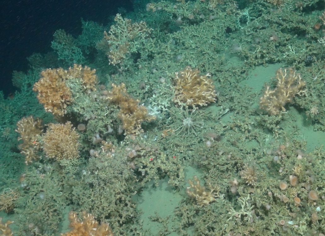
| Cold-water coral reefs | Marine habitat |
| Coral gardens | Marine habitat |
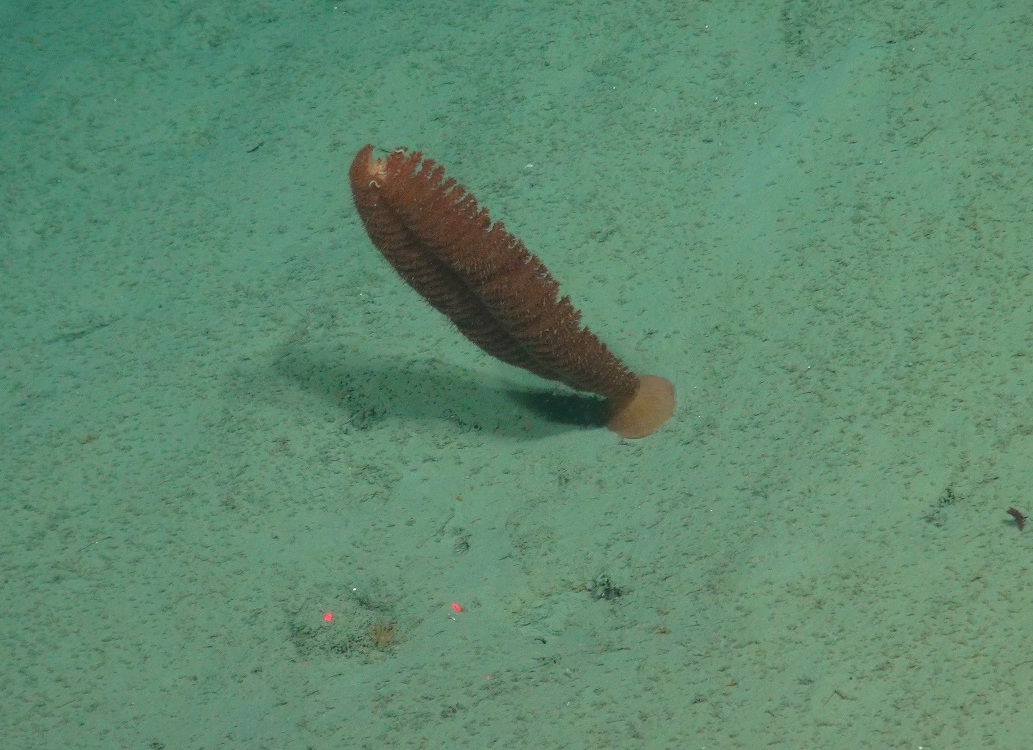
| Sea-pen and burrowing megafauna communities | Marine habitat |
Specific information on the conservation objectives relating to this site is provided in the Conservation Advice section.
The acquisition of new data may result in updates to our knowledge on feature presence and extent within this site. The most up-to-date information is reflected on the map on this page and in JNCC’s MPA Mapper and the evidence underpinning this can be viewed in the Monitoring and Evidence section.
Site Timeline
The diagram below is a summary of the key milestones involved in the selection and designation of The Canyons MCZ. More detail can be found within the Relevant Documentation section and Annex 3 of JNCC's Advice on possible offshore Marine Conservation Zones considered for consultation in 2015.
Relevant Documentation
The documents referred to below and any other historical documents relating to The Canyons were produced during the selection and designation process and therefore may be out of date. This Site Information Centre is the most up-to-date source of information for this MPA, and will reflect any additional information gathered since these documents were produced. Further information about the Marine Conservation Zone site selection process and historic MCZ advice is available on JNCC's MCZ webpage.
- The latest factsheet, site map and Designation Order is available on Defra's website.
- Site Summary Document – Summary of the key attributes of the site including boundaries, maps and descriptive text, produced as part of the site designation consultation package.
- JNCC's formal conservation advice for this site is accessible through the Conservation Advice section.
Summary
Last updated: July 2020
The information for this site summary was adapted from documents listed in the Relevant Documentation section and incorporates any information gathered since these documents were produced.
Site Overview
The Canyons MCZ is located in the far south-west corner of the UK’s continental shelf, more than 330 km from Land’s End, Cornwall. It encompasses the steep part of the shelf break where the seabed drops from a depth of 100 m to the oceanic abyssal plain at 2,000 m. This makes the site unique within the context of England’s largely shallow seas. Within the site, there are two large canyons that indent the shelf break, adding to the topographic complexity of the sea floor: the Explorer Canyon to the north and the Dangaard Canyon to the south. On the northernmost wall of the Explorer Canyon is a patch of live Cold-water coral reef (Lophelia pertusa) and Coral gardens, both of which are a OSPAR threatened and/or declining habitat. This is the only known example of living Cold-water coral reef recorded within England’s seas, making it unique in these waters. Other patches of cold-water coral reefs in the UK occur along the continental shelf break off Scotland and Ireland.
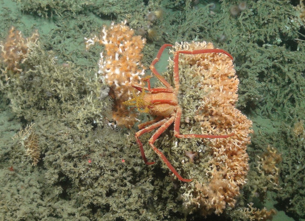
Cold-water corals and Coral gardens typically support a range of other organisms. The coral provides a three-dimensional structure and a variety of microhabitats that provide shelter and an attachment surface for other species. Both Cold-water corals and Coral gardens can be long-lived but are extremely slow growing (at about 6 mm a year), making protection important for their conservation. Another reef-forming cold-water coral, Madrepora oculata, is also present in the site.
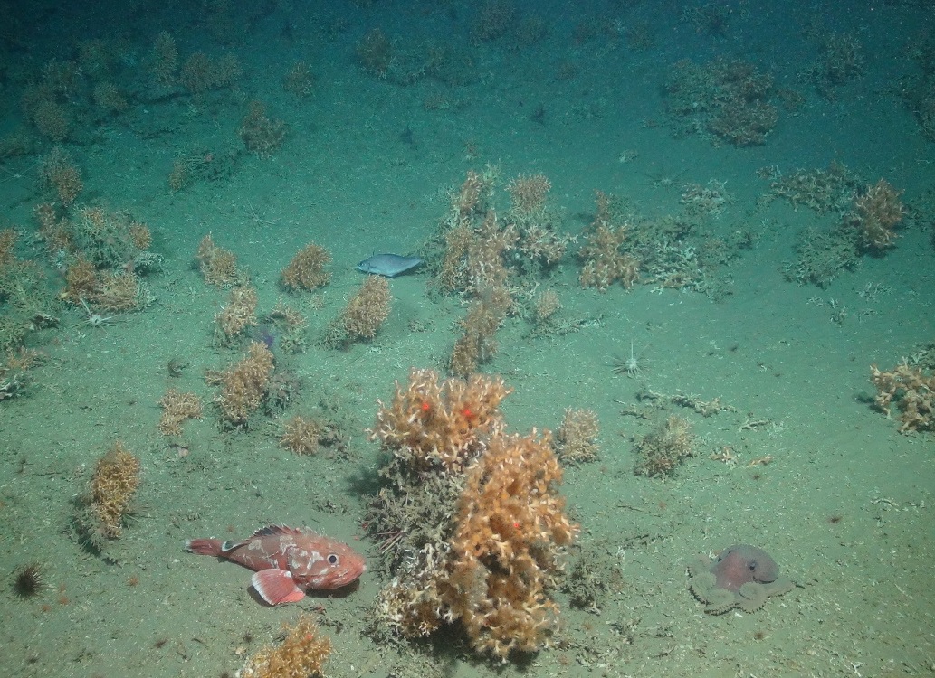
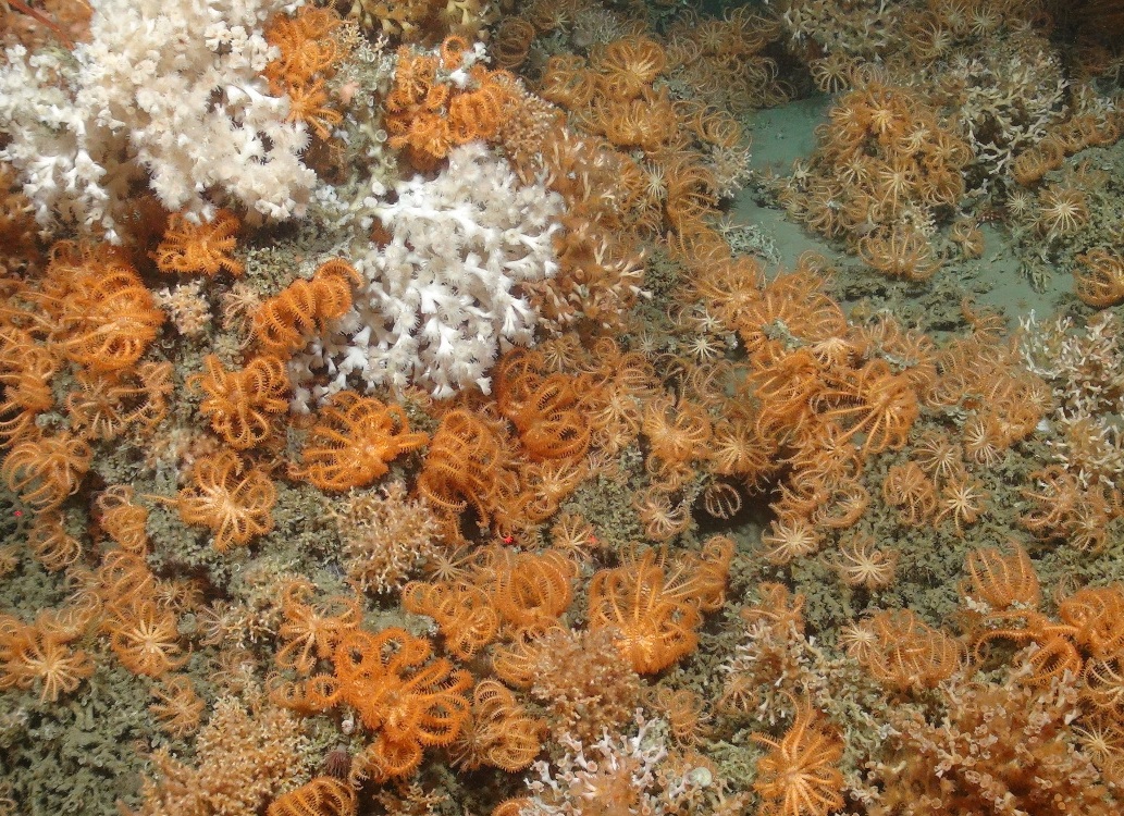
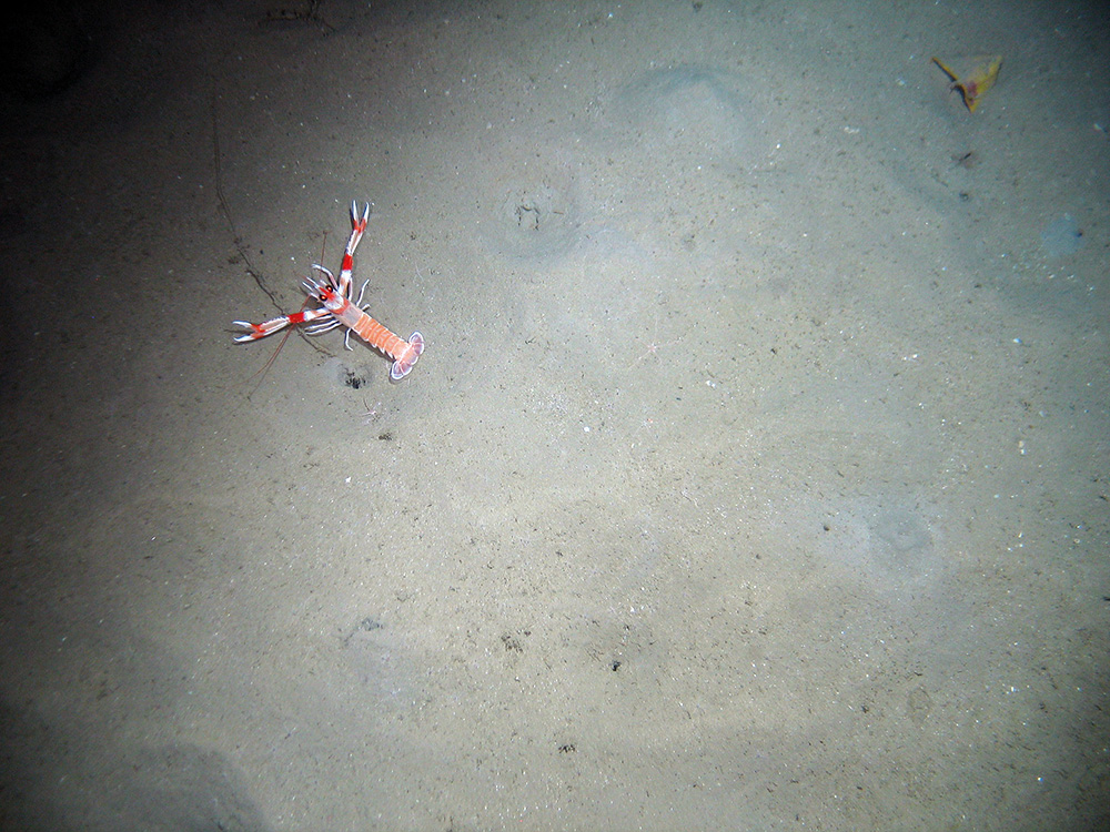
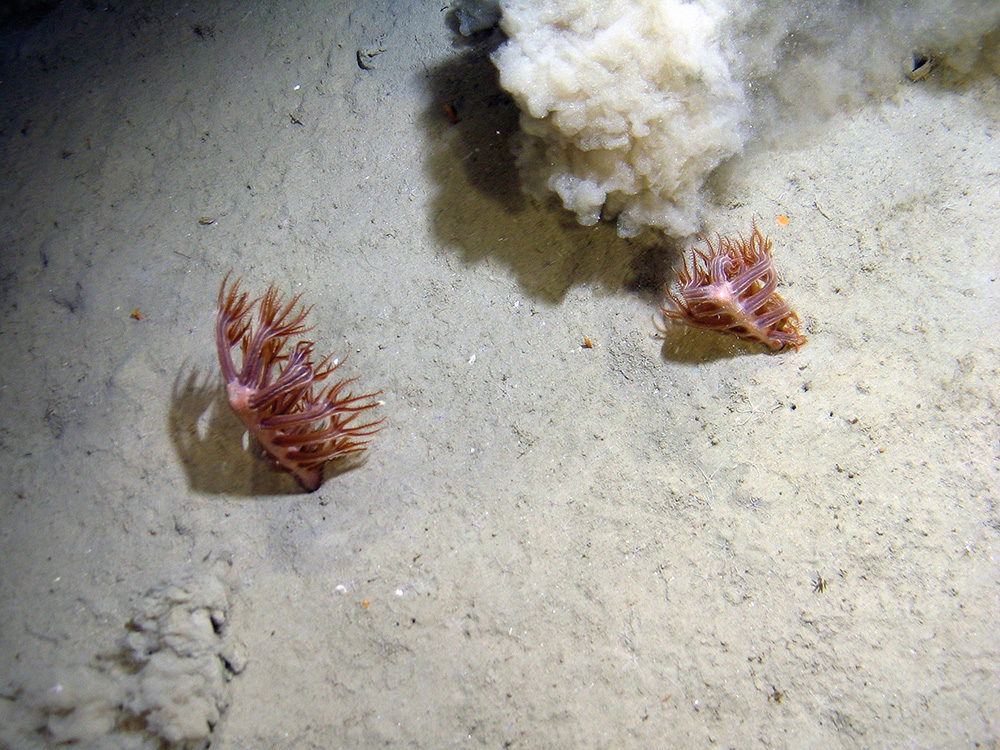
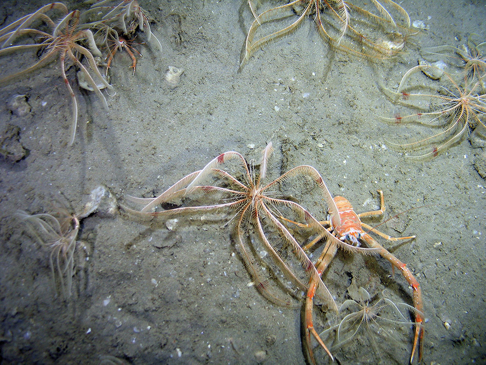
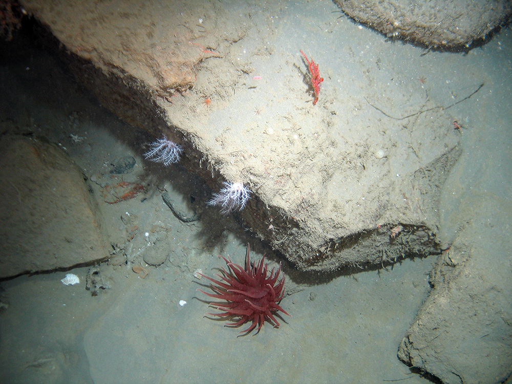
The majority of the seabed in this site occurs at depths of greater than 200 m. The variety of deep-sea bed communities present are indicative of the range of substrates found in and around the canyons, including bedrock, biogenic reef, coral rubble, coarse sediment, mud and sand. These biological communities include cold-water coral communities (Lophelia pertusa and Madrepora oculata), Coral gardens, feather star (Leptometra celtica) assemblages and Sea-pen and burrowing megafauna communities (including, burrowing anemone fields, squat lobster (Munida sp.) assemblages, barnacle assemblages and deep-sea sea-pen (Kophobelemnon sp.) fields). Further detail on the evidence for this MCZ can be found in the Monitoring and Evidence section.
Site location: Co-ordinates for this MCZ can be found in the Designation Order, available from Defra's MCZ webpage.
Site area: 661 km2.
Site depth range: Depth at the site ranges from 100 m below sea-level on the continental shelf to 2,000 m below sea-level on the deep seabed (a range of 1,900 m).
Charting Progress 2 Biogeographic Region: Western Channel and Celtic Sea.
Site boundary description: The boundaries were designed to encompass the steep part of the shelf break to cover areas of diverse seafloor habitat including sub-marine canyons and deep-sea coral habitats. The site is rectangular in shape, in line with Ecological Network Guidance (ENG) design principles. The northern and north-western boundary sections align with the UK Continental Shelf Limit. The western and eastern boundary sections were drawn as straight north–south lines. The southern boundary section was drawn to align with the old UK Continental Shelf Limit (pre-2014).
Monitoring and Evidence
Last updated: June 2026
The full overview of the data used to support the original site identification along with information on confidence in feature presence and extent is available in JNCC's advice on offshore MCZs proposed for designation in 2013 and JNCC's advice on offshore MCZs proposed for designation in 2019. JNCC will be adding relevant survey data to its MPA mapper.
Some of the data for this MCZ have been collected through JNCC-funded or collaborative surveys and some through other means. Data from surveys supports continual learning about the ecology of a site and the protected features within it. To assess feature condition and provide conservation advice for a site, JNCC draws on evidence collected during surveys. JNCC’s conservation advice supports decision-making about management of the site to achieve its conservation objectives.
Survey and data gathering
- National Oceanographic Centre (NOC) DY200 Research Expedition Report (2025) – NOC invited JNCC to collaborate on the DY200 survey to the Canyons MCZ aboard the RRS Discovery. JNCC’s aim was to collect seabed imagery data to contribute to future assessments of feature condition in the Canyons MCZ. During this survey, 15 artificial reefs were deployed on the canyon interfluves as part of the REDRESS project.
- NOC JC237 Cruise Summary Report (2022) – JNCC joined a NOC survey, in partnership with Cefas, to gather data from across The Canyons MCZ as part of the RRS James Cook Expedition 237. The survey was funded by the CLASS – Climate Linked Atlantic Sector Science (CLASS) project: Whittard Canyon and Porcupine Abyssal Plain Fixed Point Observatories project funded by NERC. The main aim was to revisit key sites last surveyed on JC125 in 2015, in the Whittard Canyon, including The Canyons MCZ.
- NOC JC166-167 Haig Fras MCZ and The Canyons MCZ Natural Environment Research Council (NERC) Cruise Report (2018) – JNCC participated on this multi-objective NERC survey to two MPAs (The Canyons MCZ and Haig Fras MCZ) in 2018. The survey was part of the NERC CLASS programme, aimed at improving understanding of Atlantic benthic ecosystems through repeated observations. The cruise mainly continued long term monitoring at Greater Haig Fras MCZ and ran equipment trials for autonomous and robotic systems, some of which required deep water work in the Whittard Canyon system. These trials were designed so that the data could also contribute to sustained observation objectives relevant to The Canyons MCZ.
- JNCC and Cefas CEND0917 2017 Cruise Report (2018) – This survey was a collaboration between JNCC and Cefas aboard the RV Cefas Endeavour to gather evidence for monitoring of The Canyons MCZ. The data collected formed the first time point of a dedicated monitoring dataset and will be used in conjunction with other available evidence to inform reports on whether the MPA is meeting its conservation objectives.
- NOC, JNCC and Cefas JC124-125-126 Cruise Report (2015) – This collaborative survey funded by Defra undertook two dives in Explorer Canyon using a NOC remotely operated vehicle, targeting a known living cold-water coral reef and an area where reef is predicted to occur according to a high-resolution habitat distribution model (see Ross et al. 2015 in the Additional relevant literature). Multibeam echosounder bathymetry data were collected covering the majority of the deepest and southerly sections of the site, where high-resolution bathymetric data have not previously been obtained.
- RV Belgica 2014/16 Cruise Report (2014) - The RV Belgica 2014/16 survey collected geological and ecological data in the Dangeard and Explorer Canyons, which form part of the wider canyon system that includes The Canyons MCZ.
- MESH South West Approaches Survey Operations Report (2007) – This collaborative survey (involving JNCC, the Marine Institute, the British Geological Survey and the University of Plymouth) on the RV Celtic Explorer collected high-quality acoustic data and took nearly 1,000 photos along 26 video transects to map the extent of deep-sea bed and cold-water coral reef habitats. The survey received Defra and European Regional Development Funding.
Data analysis reports
- NOC JC237 Research Expedition Report (2022) – The survey undertook acoustic mapping and profiling, video surveying and photography, biological sampling, coring, geological observations, eDNA sampling using a Robotic Cartridge Sampling Instrument (RoCSI), and water column observations. Data from this survey has been used for several scientific publications which can be found in the Additional relevant literature section (Keavney et al., 2025).
- NOC JC166-167 Haig Fras MCZ and The Canyons MCZ Natural Environment Research Council (NERC) (2018) – The planned work in Whittard Canyon involved extensive ROV and AUV surveys to collect video, photographs, pushcores and voucher specimens for species ground truthing and habitat comparison. Activities included mapping mini mounds, conducting sidescan and chirp surveys to assess interfluve variation and trawling impact, and repeating photogrammetry of the cold water coral reef in Explorer Canyon to detect changes since 2015. Additional tasks covered placing markers for future revisits, surveying a sandwave field to monitor migration, collecting deep pushcores for microplastic and macrofauna studies, retrieving settling experiments, and sampling cold water corals for genetic and palaeoceanographic analysis. Any data from this survey that is used for scientific publications will be added to the Additional relevant literature section.
- The Canyons MCZ Monitoring Report CEND0917 (2025) - This report explores environmental and ecological sample data, primarily acquired from the CEND0917 survey of The Canyons Marine Conservation Zone (MCZ) in 2017. The report is intended to serve as first point in a monitoring time series. The survey gathered multibeam, imagery and grab data to map habitats, characterise biological communities and establish a baseline for future monitoring. This report also features a habitat map resulting from an analysis of existing MBES (collected 2015) bathymetry and backscatter data.
- NOC, JNCC and Cefas JC124-125-126 (2015) – The data was analysed to identify areas of cold-water corals inside the Explorer Canyon in the north of the site. In addition to two planned dives over areas of known and predicted coral reef, NOC carried out a third dive in the east of the canyon and are kindly making these data available to inform our understanding of the cold-water coral reef feature. The analysis also completed a high-resolution bathymetric image of the seafloor for the majority of the site. Data from this survey has been used for several scientific publications which can be found in the Additional relevant literature section (Robert et al., 2017; Carter et al., 2018; Price et al., 2019; Iacono et al., 2020).
- MESH South West Approaches Canyons Survey Final Report (2008) – Analysis of acoustic and seismic data to determine geomorphology and sedimentary processes; and analysis of video and photographic data to determine the biological communities (biotopes) living on the deep-sea bed. These outputs were used to create broad-scale habitat and biotope maps. Data from this survey has been used for several scientific publications which can be found in the Additional relevant literature section (Davies et al., 2014; Stewart et al., 2014).
Additional relevant literature
References for further supporting scientific literature consulted during the identification of this site can be found in the annexes of our MCZ advice. Please be aware that although these sources contain information which is of interest in relation to this MPA, they do not necessarily represent the views of JNCC:
- Amaro, T., Huvenne, V.A.I., Allcock, A.L., Aslam, T., Davies, J.S., Danovaro, R., De Stigter, H.C., Duineveld, G.C.A., Gambi, C., Gooday, A.J. , Gunton, L.M., Hall, R., Howell, K.L., Ingels, J., Kiriakoulakis, K., Kershaw, C.E., Lavaleye, M.S.S., Robert K., Stewart, H., Van Rooij, D., White, M., Wilson, A.M. (2016) The Whittard Canyon – A case study of submarine canyon processes. Progress in Oceanography. Progress in Oceanography. Volume 146: P38-57, ISSN 0079-6611.
- Carter, G.D.O, Huvenne, V.A.I., Gales, J.A., Iacono, C.L., Marsh, L., Ougier-Simonin, A., Robert, K. and Wynn, R.B. (2018) Ongoing evolution of submarine canyon rockwalls; examples from the Whittard Canyon, Celtic Margin (NE Atlantic). Progress in Oceanography. Volume 169: 79-88.
- Davies, J.S., Howell, K.L., Stewart, H.A., Guinan, J. and Golding, N. (2014) Defining biological assemblages (biotopes) of conservation interest in the submarine canyons of the South West Approaches (offshore United Kingdom) for use in marine habitat mapping. Deep Sea Research Part II: Topical Studies in Oceanography. Volume 104: 208-229.
- Duineveld, G., Lavaleye, M., Berghuis, E. M., and de Wilde P. (2001) Activity and composition of the benthic fauna in the Whittard Canyon and the adjacent continental slope (NE Atlantic). Oceanologica Acta, Volume 24: 69–83. – Describes the findings of a survey investigating benthic communities and transport of organic matter in the canyons along the shelf break. The survey provided records of live cold-water coral reef within the northern extent of the northernmost canyon contained within the site as well as extensive areas of coral reef rubble elsewhere, indicating that there may have been more extensive reefs in the past.
- Ellis, J.R., Burt, G. and Rogers, S.I. (2007) Epifaunal sampling in the Celtic Sea. ICES ASC 2007. Theme Session A23. – This study undertook beam trawl groundfish surveys in 2000–2006 at the Canyons MCZ and elsewhere in the south-west offshore area. Along the edge of the continental shelf they found large numbers of the anemone Actinauge richardi, with the hermit crab Pagurus prideaux.
- Flavell, B., Carr, H., Robson, L., Byford, S., Chaniotis, P., Last, E., Long, M., Matear, L. & Novak, E. (2020) Developing the evidence-base to support climate-smart decision making on MPAs. JNCC Report No. 648. JNCC, Peterborough, ISSN 0963-8091.
- Howell, K.L., Davies, J.S and Narayanaswamy, B.E. (2010) Identifying deep-sea megafaunal epibenthic assemblages for use in habitat mapping and marine protected area network design. Journal of the Marine Biological Association of the United Kingdom, 90: 33–68. – Biological data were collected as part of this study in June 2007 along the flanks of the canyons and video data revealed the deep-sea coral communities.
- Henry, L-A. and Roberts, J.M. (2014) Developing an interim technical definition for Coral Gardens specific for UK waters and its subsequent application to verify suspected records. JNCC Report No. 507. Peterborough.
- Huvenne, V.A.I., Tyler, P.A., Masson, D.G., Fisher, E.H., Hauton, C., Hühnerbach, V., LE Bas, T.P. and Wolff, G.A. (2011) A Picture on the Wall: Innovative Mapping Reveals Cold-Water Coral Refuge in Submarine Canyon. PLoS ONE. 6(12): e28755.
- Iacono C.L., Guillen, J., Guerrero, Q., Duran, R., Wardell, C., Hall, R.A., Aslam, T., Carter, G.D.O., Gales, J.A., Huvenne, V.A.I. (2020) Bidirectional bedform fields at the head of a submarine canyon (NE Atlantic). Earth and Planetary Science Letters. 542: 116321, ISSN 0012-821X.
- JNCC. (2020) Climate Profile Report Card: The Canyons MCZ. – developed to support the project 'Developing the evidence-base to support climate-smart decision making on MPAs', the profile provides summary information about the MPA, information on its provision of climate change related ecosystem services, and information on the potential response of these features to climate change as a result of sensitivity assessments.
- Keaveney, E., Kane, I.A., Clare, M.A., Hodgson D.M., Huvenne, V.A.I., Sumner, E.J., Peakall, J., Mienis, F. and Kranenburg, J. (2025) The combined role of near-bed currents and sub-seafloor processes in the transport and pervasive burial of microplastics in submarine canyons. Journal of the Geological Society. 182.
- Pham, C.K., Ramirez, E., Alt, C.H.S, Amaro, T., Bergmann, M., Canals, M., Company, J.B., Davies, J., Duineveld, G., Galgani, F., Howell, K.L., Huvenne, V.A.I., Isidro, E., Jones, D.O.B., Lastras, G., Morato, T., Gomes-Pereira, J.N., Purser, A., Stewart, H., Tojeira I., Tubau, X., Rooij, D.V. and Tyler, P.A. (2014) Marine Litter Distribution and Density in European Seas, from the Shelves to Deep Basins. PLoS One. 9(4): e95839.
- Price, D.M., Robert, K., Callaway, A., Iacono, C.L., Hall, R.A. and Huvenne, V.A.I. (2019) Using 3D photogrammetry from ROV video to quantify cold-water coral reef structural complexity and investigate its influence on biodiversity and community assemblage. Coral Reefs. 38: 1007–1021.
- Robert, K., Huvenne, V.A.I., Georgiopoulou, A., Jones, D.O.B, Marsh, L., Carter, G.D.O. and Chaumillon, L. (2017) New approaches to high resolution mapping of marine vertical structures. Sci Rep 7: 9005 (2017).
- Ross, L.K., Ross. R.E., Stewart, H.A. and Howell, K.L. (2015) The influence of data resolution on predicted distribution and estimates of extent of current protection of three ‘listed’ deep-sea habitats. PLoS One. – Presents a high-resolution model of Lophelia pertusa reef distribution along the continental shelf of Ireland and the western waters of the United Kingdom. The model found a high likelihood of cold-water coral reef at the western edges of the Dangaard and Explorer Canyons inside The Canyons MCZ. The model considered seabed depth, slope, rugosity and curvature to determine habitat suitability for Lophelia pertusa reef, and was informed by 222 video transects recording the presence or absence of coral reef at sampling stations along the shelf break in UK and Irish waters.
- Stewart, H.A., Davies, J.S., Guinan, J. and Howell, K.L. (2014) The Dangeard and Explorer canyons, South Western Approaches UK: Geology, sedimentology and newly discovered cold-water coral mini-mounds. Deep-Sea Research II. 104: 230-244.
Knowledge gaps
As part of the UK Marine Monitoring and Assessment Strategy (UKMMAS), JNCC led the development of a UK Marine Biodiversity Monitoring Strategy, working with partners across the UK monitoring community. The Strategy spans UK territorial and offshore waters, focusing on biodiversity in the wider environment and within Marine Protected Areas. Its aim is to implement efficient, integrated monitoring of marine biodiversity to provide the evidence needed for all the UK's policy drivers.
The evidence collected during MPA monitoring surveys is used in combination with other available evidence to:
- Enable assessment of condition of the features within sites;
- Contribute to the assessment of the degree to which management measures are effective in achieving the conservation objectives for the protected features;
- Support the identification of priorities for future protection and/or management; and,
- Enable Government to fulfil its national and international assessment and reporting commitments in relation to MPAs and help identify where further action may be required.
More detail on offshore MPA monitoring can be found on the Offshore MPA monitoring webpage. A list of monitoring surveys and relevant reports can be found on the MPA monitoring survey reports webpage.
If you are aware of any additional information not referred to in any of the Relevant Documentation listed on the main page or the annexes of the MCZ advice documents, please contact us.
Conservation Advice
Last updated: May 2026
Further information on the approach used to develop this advice is available on our ‘Conserving MPAs’ webpage along with a Glossary of Terms used in JNCC conservation advice to support the use of the conservation advice packages.
You must refer to the conservation advice package for a MCZ if you are:
- intending to carry out any licensed activity in or near a MCZ and need to find out how to operate within the law;
- an authority providing advice on specific proposals;
an authority responsible for putting management measures in place. - You may also find it useful to refer to the conservation advice package for a MCZ if you are intending to carry out an activity in or near a MCZ that does not require a license.
Note JNCC’s conservation advice has undergone development and a restructure in 2025 resulting in some changes it is useful to be aware of. Amongst other changes, most notably, there are now only four documents instead of five, having merged the content previously presented in two separate documents i.e. the Conservation Objectives and Conservation Advice Statements documents into one, which is now called the Conservation Objectives and Management Advice document.
We will engage with stakeholders to identify any lessons which JNCC can learn from customers who have used the advice, with a view to continuing to ensure it is fit-for-purpose.
The following table provides an overview of the components of the conservation advice and provides hyperlinks to each. Combined, these components form JNCC’s formal conservation advice for this site and should be read in conjunction with each other. Until such times as this advice is updated, it remains JNCC’s formal conservation advice for the site.
| Document | Overview |
|
Explains where to find the advice package, JNCC's role in the provision of conservation advice, how the advice has been prepared, when to refer to it and how it can be used. |
|
|
Sets out the broad ecological aims (conservation objectives) for the site, JNCC's view of protected feature condition, the conservation benefits that the site can provide if managed effectively, and the conservation measures which JNCC consider are required to support achievement of the conservation objectives stated for the site. |
|
|
Provides more detailed and site-specific information and is essential reading to support the interpretation of the conservation objectives for the protected features of the site. Use this document to assess the impacts of your planned activity on the important attributes of the site. |
|
|
Provides information in an excel workbook on the activities capable of impacting the site's protected features and therefore achievement of the site's conservation objectives. This is a starting point for determining potential management requirements. It does not take into account the intensity frequency or cumulative impacts from activities taking place. It simply supports an understanding of the possible adverse impacts that an activity can have on a MPA's features. Guidance is imbedded to support an understanding and use of the information provided in the workbook. Use the Advice on Operations to determine those pressures an activity can cause that could harm the qualifying/protected features of the site. |
These documents are available on JNCC’s Resource Hub.
Image Gallery


Published: